A Natural Hazards Atlas for Tasmania: a major new project for Climate Futures
November 11, 2024

The risks of climate change were thrown into sharp relief this recent summer for Australia’s most southern state, Tasmania. A reduction in hydro-electric generation capacity due to dwindling dam storages was compounded by a failure of the main cable connecting Tasmania to the national grid. As power shortages loomed, the state’s major industrials were ramping down production to avoid brown outs.
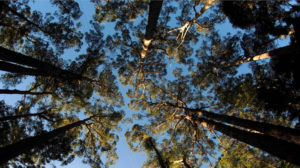
Meanwhile, in the famed UNESCO World Heritage Area, an unprecedented dry winter and spring had primed the region with dry fuel. Fire-sensitive sphagnum and alpine ecosystems had dried out so extensively that these usually damp, wet ecosystems were transformed into tinder. Ignition came from the skies above, where an abnormally unstable atmosphere sparked more than 2000 lightning strikes over a single day.
It was a testimony to the work of emergency services that no lives or property were lost. The main losses were to areas of sensitive alpine ecology, parts of which had not seen a major fire in hundreds, or possibly thousands, of years. This damage included extensive peat fields in the west, which had dried out so much they became hydrophobic. When it did finally rain, the ground remained dry and fires continued to burn underground. Anecdotal evidence suggests these underground fires resurfaced more than once to create new fire fronts.
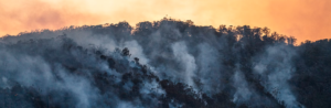
About 120-thousand hectares – or roughly 1.3 per cent – of Tasmania’s World Heritage Area was impacted by more than 300 fires. The fire season ended with a record 15 total fire ban days state-wide, five more than any previous year.
Forest fires are an emotive issue in Australia. Wildfire events, particularly those involving the loss of life or property, are usually followed by impassioned debate over the best approaches to fire safety and management. Such discussions often prompt calls for policy interventions, from increased fuel reduction burning to planning law changes that prevent new housing construction in high risk areas. Amidst these debates, the most important information for future planning has been largely out of reach. A lack of credible data about likely future pressure points, in particular how critical fire thresholds for safety and management may change in coming decades due to climate change, has been a major stumbling block for emergency management.

Only weeks before the first fires in Tasmania’s World Heritage Area started, one of the nation’s leading climate research agencies based in Hobart released the findings of a pioneering analysis of the state’s future fire danger. The findings could not have been more relevant or timely. The analysis projects that, under the IPCC’s high future emissions scenario, Tasmania can expect roughly double the fire danger over twice the area of land by the end of this century – including in the World Heritage Area.
The study, led by Dr Paul Fox Hughes at the Hobart-based Antarctic Climate and Ecosystems Cooperative Research Centre, is the highest-resolution, long-term climate modelling study of future fire risk produced in Australia. The projections indicate a continued, steady increase in fire danger throughout the century, as well as a longer and more intense fire season throughout most of the state. Most importantly for those who manage fire risk on the ground, the report provides granular detail on which geographical areas are likely to become future pressure points. The report finds:
The main output of the research comes in the form of daily values for the McArthur Forest Fire Danger Index, recorded every day between 1961 to 2100 at a resolution of 10 km by 10 km. The well-known McArthur index, which combines rainfall, evaporation, wind speed, temperature and humidity, is designed to provide a rough guide to the chance of a fire starting, as well as its rate of spread, intensity and difficulty of suppression.

The team’s analysis draws on a large and valuable future climate dataset previously produced for the ACE CRC’s Climate Futures for Tasmania project. The project which received funding from the State Government’s Climate Change Office between 2008 and 2011, provided long term climate projections aimed at assisting local decision makers and industry with climate change adaptation and planning. Using a method known as ‘dynamical downscaling’, the Climate Futures team was able to ‘enhance’ the resolution of global climate models to produce very fine scale projections that can be applied at the local level. Similar to enhancing a low resolution photograph, the process turned a single grid cell for the entire island into a grid of more than 3,000 useful locations at 10km resolution
Dynamical downscaling introduces the influence of mountains on atmospheric systems, such that the effect of rain-shadows, mountain peaks or valleys, or south facing slopes can be better represented over long time scales. Over a topographically varied region like Tasmania, the dynamical downscaling was able to capture high levels of detail about climatic variability across space and time. The sheer computing power required for the task was considerable, taking approximately 1200 days of continuous computer time on a 0.82 teraflop supercomputer to produce in excess of 75 terabytes of data. The project was arguably the highest value piece of research in this space in Australia to date, providing products that have since been used in more than 100 other projects, including this more recent assessment of fire risk.
The Future Fire Danger project represents an important step forward in our ability to forecast future scenarios, but like all models, it is imperfect. Considerable work is still needed to capture the future risk for different management zones, such as municipalities, biogeographic regions, public reserves and parks. Accurately representing fuel availability and soil dryness remains a challenge, including the transition into hydrophobic conditions in normally wet, alpine terrains observed over the summer.

Follow up discussions between the ACE CRC’s research team and operational personnel have already identified a number of potential operational impacts. Fire and emergency services personnel must manage a wide variety of complex challenges, and it is clear that these demands will continue to increase in the future. A core challenge for the emergency management sector is that factors driving both increased environmental and social vulnerabilities are changing.
Agencies such as emergency services, utility providers, park managers and forestry companies often experience significant increases in resourcing pressures during high fire danger days. Fire services may be required to roster additional personnel, or an electrical infrastructure manager may require manual inspection of faults instead of relying on automated systems. These increased demands tend to reduce the number of days available for maintaining day-to-day service levels, and increase the risk to personnel in the field. As the number of total fire ban days is projected to increase, so too will the workforce required to achieve the same day-to-day tasks within limited time. As rural communities continue to experience a decrease in available firefighting volunteers, the location of infrastructure and resources and the management of those resources will need to evolve.
The annual number of high fire danger days in Tasmania is projected to increase during this century.
These insights are helping to underpin new research by the ACE CRC team, who have extended their focus to the likely future interactions between climate change and demographic change – and the implications for emergency management. High-resolution climate modelling is helping to provide the team with improved estimates on the likely magnitude and location of capacity gaps, as well as opportunities for alternative management strategies. Another current project building on the outcomes of this work is an investigation into prescribed burning as a future management tool under a changing climate. The team is investigating how the conditions suitable for prescribed burning will change into the future, flipping the focus of the management question being address from response to mitigation.
Business leaders throughout Australia have recognised the somewhat distant impacts of ‘climate change’ are no longer so distant, as new challenges emerge into their business horizons. Strategic decisions must increasingly incorporate and manage climate risk, especially as the finance and insurance sectors embrace similar approaches.
Tasmania’s policy makers are applying such an approach to the problems presented by changing future bushfire risk. In March, the Tasmanian Government appointed ACE CRC Adjunct Dr Tony Press to head a new project to examine the impact of climate change and strengthen wilderness fire-fighting techniques in Tasmania. The Government has asked for a “warts and all examination” of the day-by-day management of bushfires in Tasmania to improve future management. Major research-gaps already identified include the likelihood of dry-lightning events into the future, development projectable fuel load indices, improved fire behaviour modelling to assist operational response. Incorporation of climate change within this project is only possible with the existence of high-quality, validated, high-resolution climate model output and the associated expert analysts to conduct the studies, all of which Tasmania has been investing in for many years.
Successfully transforming fundamental climate science into useful, usable tools for policy makers, practitioners and strategic decision makers has been developed, proven and matured in Tasmania. This framework and methodology is now ready to be rolled out across the country. Existing, generic climate tools are ready to be applied over new regions, whilst regional, specific solutions for are waiting to be developed. Through a national, collaborative approach, the research capability developed in Tasmania could be expanded and shared throughout the country to ensure the implications of climate change are considered wherever possible, promoting resilient and robust decision pathways whatever the future holds.
This article was first published in Asia Pacfic Fire Magazine.
Authors: Paul Fox-Hughes, Rebecca Harris, David Reilly, Tom Remenyi.